
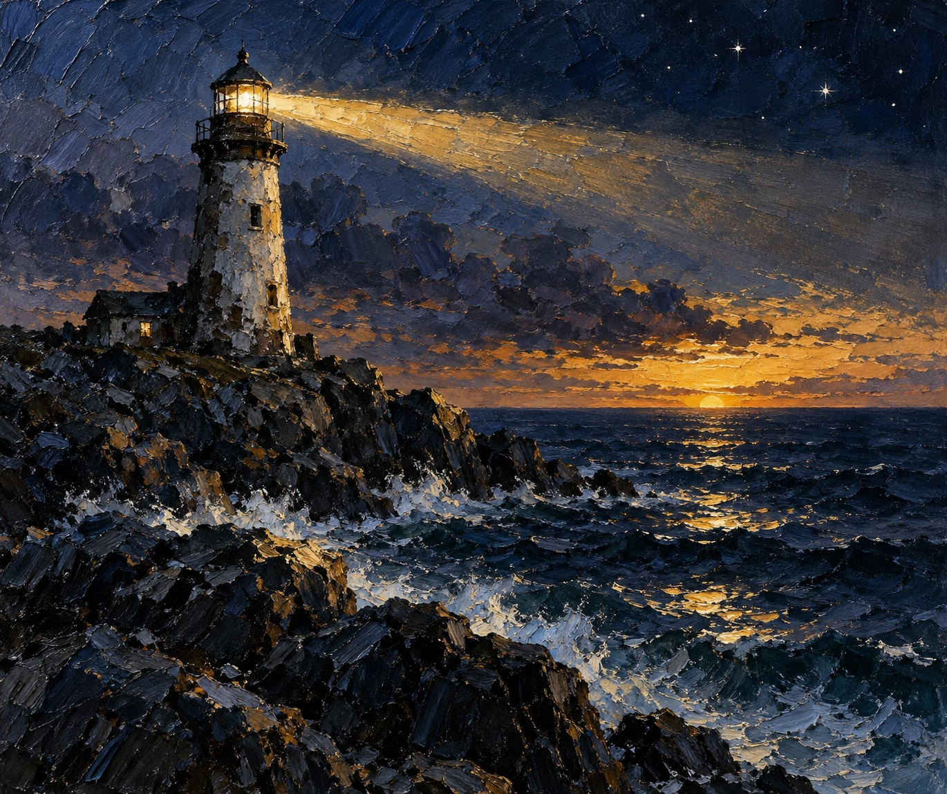
Benchmark Artifact: Ornith 1.5 35B — Freshwater Graves
Benchmark warning: This is a preserved experimental artifact generated by ornith-1.5:35b. It failed independent factual validation and may contain unsupported or incorrect claims. Do not rely on it as verified Great Lakes history.
Artifact status: It missed the requested length twice, omitted one required source in the initial/final source set, made a 1913 era error, and added unsupported technical details.
Experimental model disclosure: This article was generated by ornith-1.5:35b in a controlled long-form benchmark using a frozen evidence dossier.
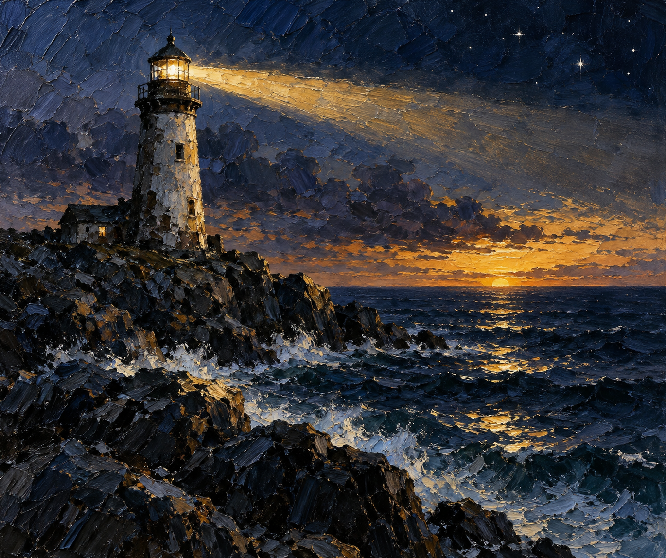
The Great Lakes are frequently described as inland seas, a phrase that captures something true about their scale and their temper even as it quietly mislabels their legal and geographic status. They are lakes. They are also, and this is the point that organizes everything below, the industrial arteries of a continent. Before railroads could claim the title, before steel rails and highways spread across the western and southern reaches of North America, the lakes carried the weight of a growing nation: passengers, timber, grain, iron ore, stone, and manufactured goods. The water that made them a transportation system also made them a graveyard, and the two facts cannot be separated without distorting either one. The bargains the lakes offered were real, and the price was real, and the effort to remember both—accurately, respectfully, and without turning grief into spectacle—is what this feature is about.
The Great Lakes became safer not because danger vanished, but because disaster was slowly converted into infrastructure, institutions, evidence, and memory.
The transformation from industrial highway to heritage landscape did not mean that shipping stopped. The lakes remain a working commercial waterway, and the freighters that once filled the horizon with smoke still move limestone, iron ore, grain, and bulk cargo along routes that have barely changed in a century. What changed is not the traffic but the way the water is remembered and read. Where a nineteenth-century observer saw a corridor of profit and risk, later generations increasingly see a cultural landscape: lighthouses preserved as monuments, wrecks managed as sanctuaries, storms studied as meteorological events, and the communities that grew around the fleets remembered as heritage rather than merely as sources of cargo. The highway still runs; the meaning around it has widened.
The evidence used to build this article comes from a fixed set of sources retrieved in October 2026, drawn from federal agencies, museums, historical societies, and regional commissions. Where sources disagree, the disagreement is preserved rather than smoothed over. Where causes remain unresolved, they are left unresolved. The goal is not to produce a tidy narrative but to produce an accurate one, and accuracy about disasters requires holding two things at once: that these losses happened to real people in real communities, and that the historical record is sometimes partial, contested, or genuinely uncertain.
The inland seas and the bargain they offered
The story begins with a simple economic fact that is easy to forget once the lakes become a backdrop for ghost stories. The Great Lakes became a major transportation network for passengers, timber, grain, iron ore, stone, and manufactured goods. That network was not a convenience layered on top of a landscape; it was the reason the landscape was worked at all. Forests were cut and their logs floated and floated downriver and out to the lakes. Iron ore was blasted from the ranges around Lake Superior and loaded in enormous quantities. Grain was scooped from fields and shipped east and south. Stone was quarried and loaded. Manufactured goods moved in the opposite direction, and people moved in every direction at once, chasing work, capital, and the promise of a new life.
The bargain was this: the lakes offered a smooth, level, gravity-assisted highway that no road of the era could match. A vessel afloat could carry far more than a wagon train could pull, and the cost per ton fell with every mile. That advantage was enormous, and it drew enormous investment, enormous labor, and enormous risk into the same enterprise. The people who worked the lakes did so because the lakes paid, and they paid well to those who survived. Those who did not survive, or whose vessels did not, learned a different lesson from the same water.
It is worth being precise about what made the network dangerous, because the causes were structural rather than mysterious. Narrow passages, shoals, fog, seasonal storms, limited early weather forecasting, wooden hulls, dense traffic, and navigation before modern electronic aids all contributed to losses. Each of these factors is ordinary in isolation. Together, they formed a system in which a single error, a single gust, a single misjudged turn could cascade into catastrophe. The lakes did not punish anyone for moral failing. They punished miscalculation, fatigue, bad luck, and the accumulated pressure of a busy shipping season.
The 16-mile Manitou Passage illustrates this compression of risk. It provided a shorter route between the Lake Michigan shoreline and the Manitou Islands, but in offering a shortcut it concentrated traffic around hazards. Ships that might otherwise have held offshore were drawn into a narrower corridor where shoals, fog, and sudden weather could all converge. Lighthouses, fog signals, a lightship, and shoal lights helped mariners navigate the passage, while South Manitou’s harbor offered refuge. Even so, the passage concentrated risk even as it reduced it, which is the paradox of every navigation aid: it lets you go where you otherwise would not, and in doing so it puts you somewhere new and unfamiliar.
The NPS page reports that between 1878 and 1898, 6,000 vessels wrecked in the Great Lakes and that 1,000 were total losses. This is an NPS-reported historical figure, and it should be treated as such rather than as a precise census. The distinction matters, because the verbs we use carry different meanings. A vessel that is wrecked has been damaged or destroyed, but wrecked does not automatically mean sunk; a ship can be wrecked against a shoal and later refloated. A vessel that is a total loss has been destroyed beyond economical repair. A vessel that is damaged has suffered harm that may or may not be fatal. These are not interchangeable, and collapsing them into a single number hides as much as it reveals. The 6,000 figure is a measure of a transportation system under sustained stress over two decades, not a tally of ships that vanished to the bottom.
Why the Great Lakes could turn lethal
The Great Lakes can produce dangerous winds, waves, rapid weather changes, freezing conditions, and low visibility. None of this makes the lakes oceans, and it is important to resist the temptation to call them so. The metaphor of the inland sea is useful for conveying scale and mood, but it is not a change in classification. The lakes are enclosed by land on every side, and that enclosure shapes everything about their behavior. Weather systems that would dissipate over an open ocean can build to violence over a lake basin bounded by shore. Cold air moving over relatively warmer water can dump snow and wind on the leeward shore in amounts that surprise people who think of the lakes as merely large ponds.
- Narrow passages and shoals that force vessels into tight corridors where a single misjudged turn can end against rock.
- Fog and low visibility that erase the horizon and the seabed alike, leaving a captain without reference points on water that offers no landmarks.
- Seasonal storms and rapid weather changes that can build to violence in a matter of hours, especially in autumn when the lakes still hold summer warmth.
- Limited early forecasting, before the point at which systematic weather observation and communication could warn a ship to seek shelter.
- Wooden hulls, which are more vulnerable to being broken against shoals and to taking on water than the steel hulls that later became standard.
- Dense traffic, in which many vessels sharing narrow routes and tight passages raise the chance of collision and concentrate risk around known hazards.
It is tempting to reduce this list to a single master cause, and it is easy to name the most dramatic one. But the evidence does not support a single explanation, and reducing the Great Lakes to one hazard would misrepresent how disasters actually happen. A narrow passage is only fatal when a ship is also running in fog, or with a wooden hull, or in dense traffic, or without reliable forecasting. No single factor operated alone; the lethality came from their combination, from a system in which ordinary risks stacked until one bad turn, one gust, or one moment of fatigue turned a routine run into a catastrophe. That is precisely why the safety improvements that followed were also systemic: no single fix could make the lakes safe, because no single cause could be blamed for their danger.
The preservation story cuts in an unexpected direction. Cold fresh water can preserve wrecks remarkably well by slowing biological and chemical deterioration compared with many saltwater settings. Saltwater hosts organisms that consume wood, and chemical reactions proceed faster in warm water. In the cold, oxygen-poor, fresh environment of the Great Lakes, those processes slow dramatically, and a wooden hull can survive beneath the surface for well over a century. This is a gift to archaeologists and a burden to anyone who cares about the sites, because a well-preserved wreck is not merely a curiosity; it is an archaeological site and often a grave or memorial landscape, not merely an adventure attraction.
Preservation is not perfect. Ice, waves, shallow-water exposure, looting, anchors, careless diving, invasive species, and time can damage sites. A wreck that survives into the twentieth century may be destroyed in the twenty-first by a careless anchor dropped by a boat that never knew it was there. The very legibility that makes a wreck worth studying also makes it worth stealing from, and the tension between access and protection is one that this feature returns to in its later sections.
Before electronics: building a chain of light
Before radio, before GPS, before the electronic aids that now let a ship know exactly where it is, mariners relied on a chain of fixed references. Lighthouses were part of a larger navigation system that included day marks, fog signals, buoys, lightships, charts, and later radio and electronic aids. No single element did the work; the system worked because the elements reinforced one another, and the failure of any one link could be fatal.
The original South Manitou light station was built in 1839 to mark the southern point of the Manitou Passage, an important route toward the Straits of Mackinac. Its purpose was not to win races but to mark a hazard and a route, to tell a captain where the southern mouth of the passage lay so that he could decide whether to enter in the light of day or hold offshore until morning. Au Sable Light on Lake Superior was constructed in 1873–74 to provide a beacon for commercial shipping, a later and larger addition to the same expanding network as traffic grew and vessels grew larger.
The Fresnel revolution
The Fresnel lens was a genuine technological breakthrough rather than a decorative flourish, and its design explains why lighthouses could see so far with such modest fuel. The lens used concentric sections of specially cut glass to collect and redirect light more efficiently than a conventional thick lens would. A conventional lens of equivalent power would have to be thick, heavy, and light-absorbing, because most of the light would be lost passing through the bulk of the glass. The Fresnel design solved this by breaking the focusing surface into a series of concentric rings, achieving the same focusing power in a flat, lightweight, transparent disc. Light that would otherwise be wasted could be bent toward the horizon, turning a modest lamp into a beam visible for many miles.
The U.S. Lighthouse Board was established in 1852, and the Clarke Historical Library says the Fresnel lens became the preferred American lighthouse apparatus and was widespread around the Great Lakes by the late nineteenth century. The lens turned a modest lamp into a beam visible for many miles, and it did so with fuel that keepers had to buy, trim, and manage by hand. Its adoption was not instantaneous; the board’s establishment marks a point at which standardized, efficient apparatus began to be systematically deployed, not a single moment when every light was upgraded at once.
It is essential to keep the limits of this technology in view. Lighthouses marked fixed hazards and routes but could not prevent structural failure, collision, human error, sudden weather, fire, or overloading. A light can tell you where the shoal is; it cannot tell you whether your hull is sound, whether your captain is tired, whether your cargo is shifting, or whether the sky is about to open. The lights reduced navigational uncertainty but did not eliminate maritime risk, and this is the distinction that any honest account must hold. The keepers’ work involved maintaining lights and stations, but this dossier does not provide enough evidence for invented daily routines or named personal stories, so those details are left out rather than fabricated.
What a lighthouse could—and could not—do
The temptation, when writing about lighthouses, is to portray them as triumphs over nature, beacons that tamed the wild water. That portrait is wrong, and it is worse than useless because it sets up an expectation that the lights could never meet. The honest account is narrower and more interesting: lighthouses symbolize safety but also reveal the limits of fixed infrastructure. They reduced risk in specific, measurable ways, and they did not eliminate it.
Consider what a light actually accomplishes. It marks a fixed point. A captain approaching a passage at dusk can see the light, determine his bearing, and decide whether he is on a safe track. He can see that he is drifting toward a shoal. He can time his arrival so that he enters the passage in daylight. In each of these cases the light provides information that changes a decision, and decisions are where disasters are often won or lost. But the light provides no information about the ship’s condition, the crew’s state, the cargo, or the weather to come. A captain who trusts a light to save him, rather than to inform him, is already in trouble.
The Manitou Passage system illustrates the point. Lighthouses, fog signals, a lightship, and shoal lights helped mariners navigate the passage, while South Manitou’s harbor offered refuge. Even with all of these in place, ships still came to harm, because the aids addressed navigation, not the totality of a voyage. A ship could be correctly navigated and still be caught by a storm, still overload, still strike a submerged object that the charts had not recorded, still be at the wrong place at the wrong time. The lights were necessary; they were not sufficient.
This is why the thesis that ties the feature together is not that the lakes were deadly because they lacked light, but that they were deadly precisely because they were a complex system in which many small failures could align. The lights were one mitigation among many, and they mitigated one class of risk among many. To credit them with safety is to misunderstand both the technology and the disasters.
A beacon could mark danger; it could not abolish it.
Rescue before the modern Coast Guard
The modern Coast Guard presence on the Great Lakes grew from predecessor services including the Lighthouse Service and Life-Saving Service. This is a fact that is often flattened in casual retelling, with the Coast Guard appearing as a timeless institution that has always been there. It has not. Federal maritime responsibilities changed and consolidated over time, and the services that did the work of prevention and rescue in any given era were the ones that existed in that era.
Shore stations, surf crews, cutters, lighthouse personnel, and later Coast Guard units formed overlapping systems of prevention and rescue. The Life-Saving Service put crews on the shore to launch line-throwing apparatus and rescue craft when a ship came in distress. The Lighthouse Service maintained the lights and the aids to navigation. The Revenue Cutter Service patrolled and could render aid. These were distinct organizations with distinct missions, distinct uniforms, and distinct histories, and they overlapped and sometimes competed before their responsibilities were consolidated. It is a mistake to merge the Lighthouse Service, Life-Saving Service, Revenue Cutter Service, and modern Coast Guard into one timeless institution.
This matters for accuracy, and it matters for respect. The people who died on the lakes were not rescued or not rescued by an abstract “Coast Guard”; they were helped or not helped by the specific services that existed at the time of their loss, by specific crews, with specific resources. To collapse those distinctions is to erase the history of the institutions and the individuals who served. This dossier does not contain a complete institutional chronology, so unsourced exact consolidation dates are avoided beyond what the linked Coast Guard sources establish. The point is that the system evolved, and the evolution is part of the story of how a deadly transportation system slowly became safer.
Lady Elgin: catastrophe and uncertain arithmetic
The sidewheel steamer Lady Elgin sank in Lake Michigan after colliding with the schooner Augusta during the night of September 7–8, 1860. This is the documented fact, and it is enough to mark the event as one of the great disasters of early Great Lakes shipping. What happened in the minutes and hours after the collision is where the record grows complicated, and the complication is not a flaw to be hidden but a feature to be understood.
Many passengers were connected to Milwaukee’s Irish community and were returning from a political excursion. They were ordinary people, returning home late at night, when the collision occurred. The vessel took on water, and the loss of life was enormous. The casualty estimates differ, and this is the tension that must be preserved rather than resolved by pretending it does not exist. The Encyclopedia of Milwaukee describes about 400 aboard and about 300 deaths; the Chicago Maritime Museum gives a range of roughly 350–380 deaths. These are not close enough to be reconciled by rounding, and they are far enough apart that any single number would be a fabrication of precision that the sources do not support.
The uncertainty is part of the historical record, not a problem to be rounded away.
The wreck influenced maritime law and public memory, but it is important not to claim one simple reform directly followed unless a source in this dossier states it. The connection between a disaster and the reforms that follow is often real but rarely linear, and the sources here do not establish a clean causal chain. What they do establish is that the Lady Elgin became a landmark in public memory, an event that people remembered and debated, and that the uncertainty about the death toll became part of its legacy.
The arithmetic itself is instructive. A vessel carrying about 400 people with an estimated 300 deaths implies that a large fraction of those aboard perished. Whether the true figure is 300 or 380, the scale of the loss is the same order of magnitude, and both figures represent a catastrophe. The disagreement is not about whether this was a disaster; it is about the exact number of the dead, and that number may never be known with certainty. Preserving that uncertainty is a form of respect for the dead, who cannot tell us how many of them there were.
The White Hurricane of 1913
The storm unfolded from November 7 through November 10, 1913, across multiple Great Lakes. This is the documented fact, and it is enough to mark the event as one of the great disasters in the history of both maritime and meteorological record. The label “White Hurricane” is a later name, and it should be used with quotation marks or explanation, because it was not a tropical hurricane. A tropical hurricane is a specific meteorological classification, a warm-core cyclone that forms over warm ocean water. The 1913 storm was a cold-core system, a nor’easter–type disturbance that drew energy from the interaction of cold air and relatively warmer lake water. Calling it a “White Hurricane” is a figure of speech, a way of conveying the white foam and the hurricane-force winds, not a scientific classification.
The NWS meteorological review reports at least 258 lives lost, 12 ships sunk, and 30 other vessels crippled. These are the documented figures, and they should be reported as such. The distinction between sunk and crippled is important: twelve ships were destroyed, and thirty more were damaged beyond safe operation but not necessarily lost. The total toll is staggering, and it was concentrated where the storm’s energy focused. Lake Huron suffered especially severe losses. The Isaac M. Scott, a 504-foot steel freighter, was lost with its crew and was later found within the Thunder Bay sanctuary region. Its loss is one of the specific threads in a storm that claimed so many that the individual stories are difficult to disentangle.
The event belongs in both maritime and meteorological history, and this dual identity is worth emphasizing. Forecasting, communications, ship design, operational decisions, and a complex storm system all matter. The storm tested the limits of mid-nineteenth-century forecasting, which had no way to predict a system of this intensity forming so rapidly over the lakes. It tested the communications infrastructure, which relied on telegraph and signal stations that could fail in the wind. It tested ship design, as wooden and steel vessels alike were caught. It tested operational decisions, as captains chose when to seek shelter and when to run. And it tested the storm system itself, which was unusually complex and intense.
It is important not to invent a single master cause for every loss. The 1913 storm was not caused by one thing; it was the product of a confluence of conditions, and the individual ships were lost for individual reasons that are not fully known. To reduce the disaster to a single cause would be to misunderstand it, and the honest account holds the complexity rather than resolving it.
Eastland: a Great Lakes disaster in the Chicago River
The geography matters: Eastland capsized in the Chicago River, not on open Lake Michigan.
On July 24, 1915, the passenger vessel Eastland capsized while tied to a dock in the Chicago River before a Western Electric company excursion. This is the documented fact, and it is enough to mark the event as one of the deadliest single-day maritime disasters in Great Lakes history. The tension here is geographic, and it must be named rather than smoothed over: the Eastland belongs to regional Great Lakes history and to the broader transportation system, but it capsized in a river, not on the open waters of a Great Lake. To call it a Great Lakes disaster without qualification would be to mislabel its location. It still belongs to Great Lakes regional transportation history, because it involved a vessel of that system and workers drawn into that industrial network, but its location was a river in the heart of an industrial city, not the open waters of a Great Lake.
At least 844 people died; the local museum states that 22 entire families were among the dead. These figures represent a catastrophe of enormous scale, concentrated in a single morning on a river in the heart of an industrial city. The ship rolled onto its side in roughly 20 feet of water, trapping many people below. The shallowness of the water did not save lives; it trapped them, because the vessel fell onto its side and the compartments below the waterline filled or remained inaccessible. The number of dead is among the highest of any Great Lakes disaster, and it exceeds the death toll of some events that are more widely remembered.
This is the fifth theme that the feature must hold: famous losses can overshadow deadlier or socially revealing disasters. The Eastland is a case in point. It happened in a river, away from the romantic waters of an open lake, and it involved office workers and factory employees rather than seasoned lake sailors, and so it has not received the same cultural attention. But the scale of the loss was enormous, and the 22 families lost entirely represent a concentration of grief that is difficult to comprehend.
Questions of stability, loading, design, regulation, and added lifeboat weight form part of the larger history, but this dossier does not provide enough evidence to assign one exclusive cause. Present causation cautiously. The Eastland may have been top-heavy, over loaded, or affected by free surface effect as water accumulated on the deck; the sources do not establish a single conclusive explanation, and to invent one would be to betray the evidence. The honest account is that the causes are debated and unresolved, and that the human cost was real regardless of the technical explanation.
Carl D. Bradley and the cost to a company town
The limestone carrier Carl D. Bradley departed Buffington, Indiana, on November 17, 1958, bound north on Lake Michigan toward the Port of Calcite. This is the documented fact, and it marks the vessel as a product of a mature industrial era. By 1958, the Great Lakes fleet was largely steel, powered by diesel, and carrying bulk cargo on scheduled runs. The Bradley was one link in a supply chain that moved limestone from the quarries of northern Michigan to the furnaces that needed it. Its departure was routine; its return never came.
The vessel was caught in severe weather and broke apart on November 18. Of 35 crew members, two survived. The Wisconsin Marine Historical Society identifies survivors First Mate Elmer Fleming and deckhand Frank Mays. Two survivors out of 35 is a staggering loss, and it is worth holding that number, because it conveys the suddenness and totality of the event. The Bradley did not sink gently; it broke apart, and the crew had little time.
The loss devastated Rogers City and other northern Michigan communities closely tied to the limestone fleet. This is the sixth theme, and it is one that the feature must emphasize: disasters emerge from systems, and their costs are distributed through communities, not just across water. Rogers City was a company town in the sense that its economy and identity were tied to the limestone fleet, and the loss of the Bradley was not merely the loss of a ship and its crew; it was the loss of neighbors, friends, and a way of life. The men who died were not anonymous mariners; they were the sons, brothers, fathers, and friends of a specific place.
Structural condition, age, weather, and operational history are relevant, but do not invent a conclusive failure sequence beyond the supplied sources. The Bradley broke apart, and the reasons are debated; the honest account is that the specific cause is not established by this dossier. It is important not to confuse the Bradley with Edmund Fitzgerald: different lake, year, cargo context, and casualty outcome. The Bradley sank in Lake Michigan in 1958 with the loss of 33 of its 35 crew; the Fitzgerald sank in Lake Superior in 1975 with the loss of all 29. They are distinct events, and conflating them would be a serious error.
Bradley had two survivors; Fitzgerald had none.
Edmund Fitzgerald: fame, evidence, and unresolved cause
Edmund Fitzgerald was lost in Lake Superior on November 10, 1975, with all 29 crew members. This is the documented fact, and it is enough to mark the event as one of the most famous disasters in Great Lakes history. The Great Lakes Shipwreck Historical Society places the loss about 17 miles north-northwest of Whitefish Point, Michigan. The freighter was carrying taconite pellets, a processed form of iron ore that had become the dominant cargo of the later era. No distress call settled the mystery, and no crew member survived to describe the final moments. These two facts—the absence of a clear distress call and the absence of survivors—are what make the Fitzgerald’s fate genuinely unresolved.
The Coast Guard said the cause “could not be conclusively determined.” This is the central fact, and it must be held firmly: the official investigation did not reach a conclusive determination. Its most probable explanation involved loss of buoyancy from massive flooding of the cargo hold, with the concern that hatch closures had been ineffective emphasized in the Coast Guard theory. If water entered through hatches that did not seal properly, the cargo hold could flood and the freighter could lose buoyancy. This is the leading hypothesis, and it is a hypothesis, not a conclusion. It should not be elevated into certainty, and no extra theories are introduced here beyond what the Coast Guard’s own analysis carried.
The fame of the Fitzgerald is a cultural phenomenon as much as a maritime one. Gordon Lightfoot’s song helped transform the wreck into a widely known cultural memorial. This feature discusses cultural memory without quoting copyrighted lyrics, and it is worth noting that the song’s popularity has, in some accounts, overshadowed the historical and archaeological record. The Fitzgerald is among the most famous Great Lakes disasters, but it is not the deadliest event in this dossier. The Eastland killed more people in a single morning; the 1913 storm killed more than 250. Fame and death toll are not correlated, and it is important to hold both facts without letting one distort the other.
The unresolved cause is not a failure of the record so much as a feature of it. Some events cannot be resolved with certainty, and the Fitzgerald is one of them. The honest account is that the Coast Guard could not determine the cause, that the most probable explanation involves flooding through poorly closed hatches, and that this remains an open question. To claim certainty would be to betray the evidence; to embrace the uncertainty is to respect it.
Why some wrecks survive
The preservation of wrecks in the Great Lakes is a scientific fact with cultural consequences. Cold fresh water can preserve wrecks remarkably well by slowing biological and chemical deterioration compared with many saltwater settings. In saltwater, marine borers consume wood, and chemical corrosion proceeds faster in warm water. In the cold, often oxygen-poor, fresh environment of the Great Lakes, those processes slow dramatically, and wooden hulls, decks, and even organic cargo can survive for well over a century beneath the surface.
This preservation is not uniform, and it is not permanent. Ice, waves, shallow-water exposure, looting, anchors, careless diving, invasive species, and time can damage sites. A wreck that survives into the modern era can be destroyed in a single afternoon by an anchor dropped by a boat that never knew it was there, or by the invasive species that bore into wood and shell alike. Preservation is a race between the processes that protect and the processes that destroy, and it is a race that is never finally won.
A preserved wreck is an archaeological site and often a grave or memorial landscape, not merely an adventure attraction. This is the seventh theme, and it is one that the feature must hold throughout: preservation requires balancing research, tourism, community memory, and respect for graves. A wreck that survives is valuable precisely because it is evidence, and evidence is destroyed when it is removed or damaged. The same qualities that make a wreck worth visiting—its preservation, its legibility—make it worth destroying, and the tension between access and protection is central to the ethics of this history.
The Thunder Bay region illustrates the point. Thunder Bay’s combination of unpredictable weather, fog, sudden gales, and rocky shoals contributed to the “Shipwreck Alley” name, and the cold, fresh water preserved what the storms claimed. The vessels that sank there are among the best-preserved in the Great Lakes, and they are also among the most visited, which is why the management of access is so important.
From wreck sites to cultural landscapes
The modern approach to these wrecks is to see them not as isolated hulls but as parts of a connected cultural landscape. This is a shift in thinking that has profound implications for how we study, interpret, and protect them. A wreck is not merely a ship that sank; it is evidence about labor, technology, trade, migration, risk, regulation, and community. It is a node in a network that includes the ports where it was built, the communities where its cargo was loaded and unloaded, the companies that owned it, the families that worked it, and the places that remembered it.
Thunder Bay National Marine Sanctuary covers roughly 4,300 square miles of northwestern Lake Huron. NOAA says fire, ice, collision, and storms claimed nearly 200 vessels in and around Thunder Bay. The sanctuary protects a nationally significant collection of historic shipwrecks and interprets almost 100 shipwreck stories. The sanctuary combines archaeology, conservation, education, mooring systems, diving, research, and shore-based interpretation. This is not a single site but a system, a network of protected waters, interpreted stories, and managed access.
It is important to understand that “nearly 200 vessels claimed” and “almost 100 stories” are not contradictory, and they are not the same count. They describe different inventories and interpretive coverage. The nearly 200 figure is a measure of vessels lost over time in the region; the almost 100 figure is a measure of the stories that the sanctuary has chosen to interpret and present. One is a count of losses; the other is a count of interpretive output. Do not turn either into an exact discovered-wreck count, because neither is. The number of wrecks actually discovered and mapped is smaller than the number claimed, and the number interpreted is smaller still.
The Wisconsin Shipwreck Coast National Marine Sanctuary extends this logic. It is co-managed with Wisconsin, and NOAA describes a nationally significant collection of 40 well-preserved historic shipwrecks along Wisconsin’s Lake Michigan coast. The cultural landscape includes ports, lighthouses, working waterfronts, migration, industry, communities, and the submerged sites—not just isolated hulls. NOAA notes that cold freshwater provides unusually good conditions for studying historic wrecks. The Wisconsin Historical Society portal connects individual wreck histories with museums, parks, lighthouses, and visitor resources. Again, the point is the network: the wrecks are connected to the shore, to the communities, and to the broader story of the lakes.
Archaeology, tourism, and the ethics of looking
Archaeologists document construction, cargo, machinery, site formation, damage, and change over time. This is the work that turns a wreck from a mystery into a record. Remote sensing, sonar, photogrammetry, remotely operated vehicles, archival research, diver observation, and mapping can complement one another, and the best studies combine several. A wreck is evidence about labor, technology, trade, migration, risk, regulation, and community—not only the moment of sinking. The moment of sinking is important, but it is one moment in a long life, and the archaeology recovers the whole life, not just the death.
What researchers can learn without taking artifacts
- Remote sensing, which maps the seabed and detects anomalies without touching the site.
- Sonar, which builds detailed images of a wreck’s shape and surroundings through sound.
- Photogrammetry, which reconstructs three-dimensional models from overlapping photographs.
- Remotely operated vehicles, which can observe a wreck at depth without placing a diver in the water.
- Archival research, which places the wreck in its operational history through documents, charts, and records.
- Diver observation and mapping, which record a wreck’s condition and layout without removing anything.
Each of these methods lets researchers learn about a wreck without disturbing it, and the shared principle is that the site itself is the primary source. When an artifact is removed from a site, the context in which it was found is destroyed, and context is often more valuable than the artifact itself. A bolt in its place tells you how the hull was fastened; a bolt in a collector’s drawer tells you only that a bolt existed. Removing an artifact severs the object from the evidence that explains it, turning a rich archaeological record into a lonely souvenir. This is why the ethics of looking require that we value the site more than the souvenir, and why lawful, non-destructive visitation and respect for human remains and memorial meaning must guide every encounter.
Artifact removal can destroy context. This is the ethical crux. When an artifact is removed from a site, the context in which it was found is destroyed, and context is often more valuable than the artifact itself. A bolt in its place tells you how the hull was fastened; a bolt in a collector’s drawer tells you only that a bolt existed. Encourage lawful, non-destructive visitation and respect for human remains and memorial meaning. Do not provide precise coordinates for sensitive wrecks or advice that facilitates looting. The ethics of looking require that we value the site more than the souvenir.
This is where the tension between tourism and protection is sharpest. Public engagement is valuable; it builds support for protection and connects people to history. But engagement that damages the site is self-defeating, and the goal must be engagement that sustains the site rather than consumes it. The sanctuaries and museums that manage this balance are doing difficult work, and they should be supported rather than undermined by visitors who treat the sites as playgrounds rather than as graves and archives.
How to encounter this history responsibly
Public engagement can include museums, lighthouse tours, shore-based heritage trails, glass-bottom boat experiences, exhibits, historic districts, and properly managed diving. These are legitimate and valuable ways to encounter this history, and they should be encouraged. But they come with responsibilities, and the responsibilities are best understood at the level supported by the sources.
Conditions, accessibility, hours, fees, dive qualifications, and seasonal operations change. The article should send readers to official current pages rather than inventing an itinerary. It is not possible, and it would be irresponsible, to list specific hours or fees, because those change and because any specific claim would quickly become inaccurate. The responsible move is to direct readers to the official sources, which are current and authoritative, and to tell readers to verify current official information for access, safety, qualifications, schedules, and fees.
Whitefish Point connects lighthouse history, Lake Superior shipping, rescue history, and Edmund Fitzgerald memory. It is a place where the themes of the feature converge: the light, the shipping, the rescue, the memorial. Alpena and Thunder Bay provide a combined sanctuary, museum, trail, and research story. Wisconsin’s Lake Michigan shore connects lighthouses, port communities, museums, and sanctuary interpretation. These are the anchors of a broader network, and they are best approached through their official resources rather than through an invented itinerary.
Do not claim every site is open, staffed, free, accessible, or safe year-round. Some are; some are not; and the answer changes with the season, with funding, and with conditions. The responsible visitor checks the official source before setting out, and treats the sites with the respect due to graves and archives rather than the casual expectation of a theme park.
What the wrecks still ask of us
The wrecks of the Great Lakes are not merely relics of a past that is gone; they are ongoing questions, and the questions are as urgent now as they were when the ships went down. They ask us to remember accurately, to hold the uncertainty rather than to resolve it falsely. They ask us to respect the dead as individuals rather than as props for narrative. They ask us to balance access with protection, and to value the site more than the souvenir. They ask us to see the disasters as systemic rather than as the work of a romantic villain, and to understand that the systems that made the lakes deadly are the same systems that made them indispensable.
The thesis that ties this feature together is that the Great Lakes were industrial highways before they became heritage landscapes, and that the disasters emerged from systems—weather, technology, commerce, regulation, communication, and human decisions—not from one villain. The lighthouses symbolize safety but also reveal the limits of fixed infrastructure. The wrecks are unusually legible archives because of freshwater preservation. Famous losses can overshadow deadlier or socially revealing disasters. And preservation requires balancing research, tourism, community memory, and respect for graves. These are not separate points but a single argument, and the argument is that the lakes offered a bargain that was real and that had a price, and that the price was paid in ships and in lives and in communities.
The wrecks still ask of us that we keep the bargain in view, that we remember both the advantage and the cost, and that we treat the sites with the respect they deserve. They ask that we preserve the uncertainty rather than falsify it, that we honor the dead rather than exploit them, and that we connect the scattered wrecks into a cultural landscape that honors the whole story, not just the most famous chapters. This is not a easy task, and it is not a finished one, but it is the task that the wrecks set before us, and it is a task worth undertaking.
Our obligation to evidence comes first, because accuracy is the form of respect these sites demand: we must preserve the uncertainty rather than smooth it away, name the sources rather than hide them, and refuse the false precision that a tidy narrative would offer. Our obligation to the dead and their communities comes next, because the wrecks are graves and memorials as much as archaeological sites, and the people who perished were real, named, and remembered by real communities that still exist. Our obligation to preserve the record for future readers follows from both, because a cultural landscape that loses its sources loses its meaning, and the institutions that hold these stories must be supported rather than undermined. The wrecks did not sink to become spectacles; they sank as part of a bargain that built a continent, and keeping that bargain in view—advantage and cost together—is what they still ask of us.
Sources
- National Park Service, “Booms and Busts of the Great Lakes and Manitou Passage”
- Library of Congress, South Manitou Island light station
- Library of Congress, Au Sable Light Station
- National Park Service, Fresnel Lens
- Clarke Historical Library, History of Michigan Lighthouses
- U.S. Coast Guard Historian, Lifesaving Service
- U.S. Coast Guard, Ninth District history
- National Weather Service, “Remembering the November 1913 White Hurricane”
- NOAA, Thunder Bay condition history
- NOAA, “History Meets Technology in Shipwreck Alley”
- Encyclopedia of Milwaukee, Lady Elgin
- Chicago Maritime Museum, Shipwrecks
- Great Lakes Commission news summary, Lady Elgin
- National Weather Service meteorological review PDF, 1913 Storm
- NOAA, shipwrecks, damages, and casualties archive
- Britannica, Eastland disaster
- Oak Park River Forest Museum, Eastland disaster
- Presque Isle County Historical Museum, Carl D. Bradley
- Wisconsin Marine Historical Society, Lake Michigan Claims the Carl D. Bradley
- Great Lakes Shipwreck Historical Society, Edmund Fitzgerald overview
- Official U.S. Coast Guard marine casualty report, Edmund Fitzgerald
- National Museum of the Great Lakes, Coast Guard report summary
- NOAA Thunder Bay sanctuary
- NOAA Thunder Bay heritage
- NOAA sentinel site description, Thunder Bay
- NOAA cultural landscape study
- NOAA Ocean Exploration expedition, Wisconsin Shipwreck Coast
- Wisconsin Historical Society shipwreck portal
- Wisconsin Historical Society, underwater archaeology
- NOAA archaeology updates
- NOAA Thunder Bay places
- Great Lakes Shipwreck Museum
Model and run details
- Generating model: ornith-1.5:35b
- Runtime: Ollama GGUF Q4_K_M
- Context and settings: 65,536 tokens; temperature 0.35; thinking disabled; 16,000-token output ceiling.
- Initial endurance run: 6,421 words, 9,313 output tokens, 94.002 seconds.
- Revision run: 7,220 words, 10,363 output tokens, 107.495 seconds.
- Revision instructions completed: 9/12.
- Independent factual score: 7.5/10; not release-safe.
- Independent blind style score: 8.5/10 (blind rank 1 of 3).
Method note: Aura supplied the frozen workflow, evidence dossier, and revision instructions; executed the calls and publication; and did not silently rewrite the model candidate. The warning and run-details sections are editorial framing around the preserved output.